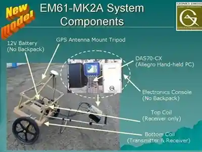
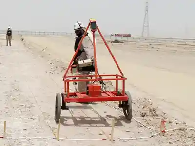
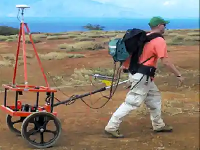
HORIZON has the capability to use EM- 61 MK2A for Geophysical survey of dry area and for obtaining digital geophysical mapping (DGM).
EM61-MK2A HP Metal Detector is a high power, high sensitivity metal detector suitable for applications in the detection of both ferrous and non-ferrous metal.
HORIZON has the capability to use this equipment in the manual as well as the towed array mode.
EM61-S
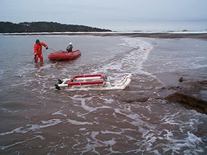
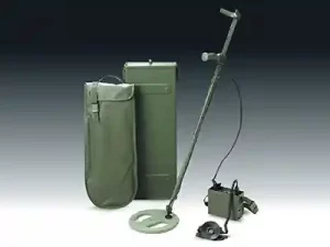
This will be used for operations in the wet pits in marine environments. It is a completely submersible coil and cable system capable of submersion to depths of more than 60 m. Available as an attachment to the standard EM61-MK2, the EM61-S includes a single coincident transmitter / receiver coil, with cable.
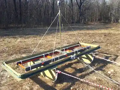
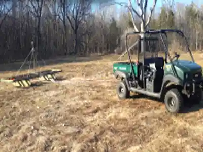
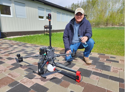
EM- 63 Flex Array
Designed to be adaptable and used in a various environments, the EM63 Flex can be configured to support the project application and specific survey requirements the customer may require. The maximum number of receiver coils that can be used for each application is four, which can give you a swath distance of four meters in length.
Ferrous and non-ferrous metallic targets will have a greater response due to the high power of this system enabling the user to detect objects with high precision and enhance the probability of detection. For example, a 60mm mortar shell can be detected to a depth > 95cm and a larger target to a maximum depth of 6m beneath the sensor (depending on the site conditions).
UPEX 740 M Large Loop Metal Detector
HORIZON has the capability to use UPEX 740 M Large Loop Metal Detector (LLMD) for Geophysical survey of dry area and for obtaining digital geophysical mapping (DGM).
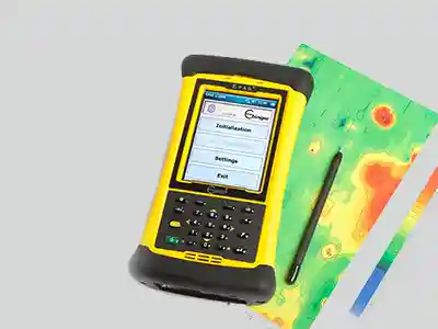
HORIZON also uses the EPAS® software to improve productivity, efficiency and quality in geophysical surveys and ERW clearance operations.
HORIZON has the capability to use this equipment in the manual as well as the towed array mode.
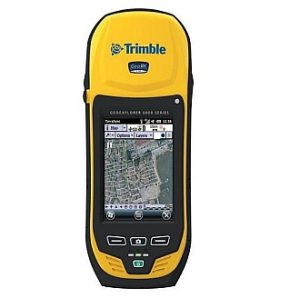
DGPS 6000 Series
The Trimble GeoExplorer 6000 series is the ultimate platform for collecting and maintaining high accuracy GNSS data in the field. With Floodlight Technology, the 6000 series can compute positions even with very weak satellite signals. The 6000 using both GNSS and GLONASS satellites give incredible performance under tree canopy and urban canyons. The 4.2″ polarized screen includes a sunlight-optimized display designed for outdoor operations. The 6000 series includes a 5 megapixel autofocus camera with geo-tagging capability. The photo capture can be linked to GIS features with ease. An optional 3.5G cellular modem is available. Post processing accuracy for the GeoXH is 10cm With H-Star technology, there’s no need to initialize—in the time taken to record attribute information, the GeoXH handheld logs the data needed to achieve sub-foot accuracy.
F3 Mine Lab Metal Detector
This hand held detector is used by HORIZON as an aid to the EOD teams during survey, marking and intrusive investigations
All - Metal Detector
This hand held All-metal detector is used by HORIZON as an aid to the EOD teams during survey, marking and intrusive investigations especially in ground conditions where there are many non ferrous metal contamination such as aluminum drink cans etc.
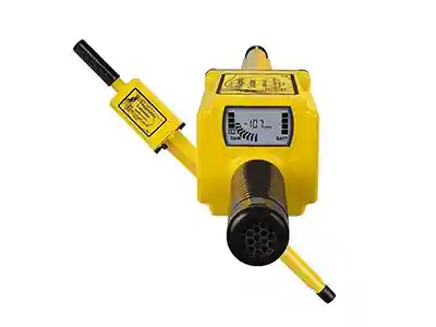
SCHONSTEDT GA 72 Cd
This hand held detector is used by HORIZON as an aid to the EOD teams during survey, marking and intrusive investigations
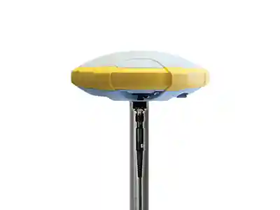
TRIMBLE R4s GNSS SYSTEM
HORIZON has the capability to use Trimble R4s GNSS System for survey grade boundary marking, Obstacles marking and Target reacquisition of DGM Targets of Interest.
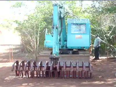
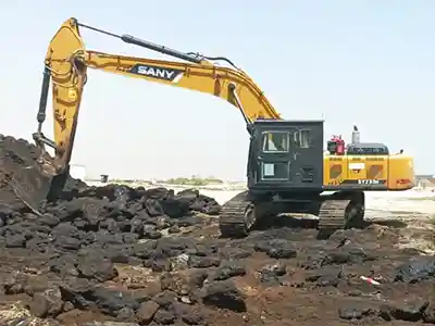
GROUND PREPARATION MACHINE
The machines will be utilised to expose the position of the UXOs .
The machine’s cabin and engine portion is protected against blast.
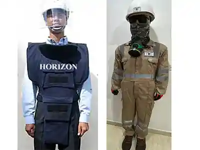
Personnel Protective Equipment
HORIZON ‘s EOD technicians wear PPE to protect the body from head to toe
Helmets with protective visor, fragment proof body armour and demining shoes.
All PPE comply with the relevant BS or ANSI or equivalent International Standards concerning the design or manufacture of the PPE with regard to health and safety.
Drone Survey Equipment
Horizon specializes in providing UXO, topographical ,bathymetric, sub-surface survey and other mapping services using cutting-edge drone technology. Horizon magnetometers detect changes in the Earth’s magnetic field, which help locate UXOs and other buried objects.
Our team can create a map of the magnetic anomalies in an area, allowing for the identification of potential UXO locations.
Horizon has a wide array of sensors like echo sounders, LiDAR, magnetometers, and electromagnetic sensors.
We provide High-quality data and detailed imagery.
Survey underwater topography and bathymetry, making them ideal for coastal engineering, oceanographic research, and hydrographic surveys.